


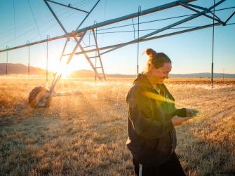
This web platform taps satellites to transform water management
OpenET fills a major data gap for farmers and water managers in the arid West
Water scarcity is one of the most serious consequences of climate change, especially in the arid western United States.
Water is crucial to maintaining the health of communities, rivers and wildlife, and nothing is more important to producing food for the world’s growing population.
Despite water’s importance, one of the most critical pieces of information for managing water — data on water consumed by crops and other plants — has been limited and expensive to access for most farmers and decision-makers.
OpenET aims to fill this major gap and accelerate innovation and conservation in water management by providing consistent, easily accessible satellite-based data on this water consumption for 17 western states.
What is OpenET?
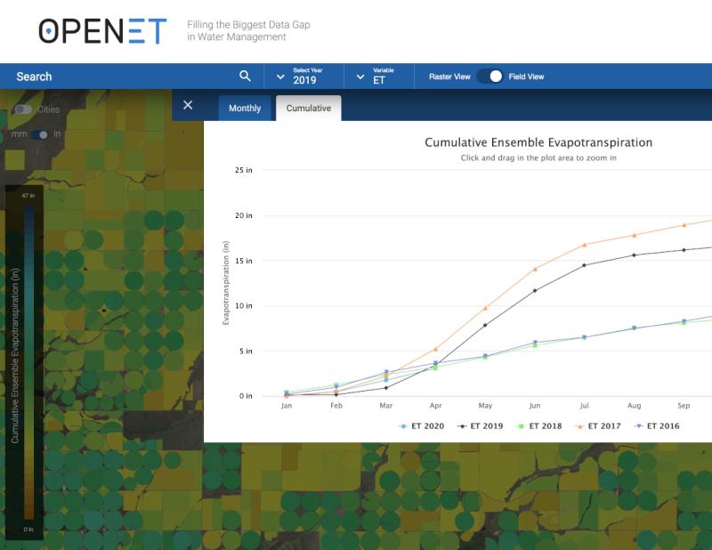
OpenET is an online platform that uses the best available science and publicly available satellite and weather station data to estimate water consumption down to the field level at monthly and yearly intervals. It launched in 17 states in October 2021.
Like other EDF efforts using technological innovation to drive environmental change, OpenET is about turning data into action. OpenET brings together several commonly used models for estimating water consumed by crops and other vegetation onto one single, widely accessible online platform for the first time. This enables more collaboration and the development of more innovative solutions to address water challenges across the western United States.
Applications of OpenET data include:
- Informing irrigation management and scheduling practices to maximize “crop per drop” and reduce costs for water and fertilizer.
- Enabling water and land managers to develop more accurate water budgets and innovative management programs that promote adequate water supplies for agriculture, people and ecosystems.
- Supporting groundwater management, water trading and conservation programs that protect the economic viability of agriculture across the West.
The "ET" in OpenET stands for evapotranspiration — the process by which water evaporates from the land surface and transpires from plants. ET is a key component in the water cycle. Satellites that measure surface temperatures can help track ET because plants and soils cool down as water evaporates and transpires, so areas with increased ET appear cooler in satellite images.
An unprecedented collaboration for “game-changing” technology
OpenET is being led by Environmental Defense Fund, NASA, the Desert Research Institute and web developer Habitat Seven, with in-kind support from Google Earth Engine.
The project has brought together leading scientists in satellite-based water estimates and more than 100 growers, ranchers and water managers across the West to create a user-friendly platform. Additional project partners include the U.S. Geological Society (USGS), U.S. Department of Agriculture (USDA), California State University Monterey Bay, University of Idaho, University of Maryland, University of Nebraska-Lincoln, and University of Wisconsin-Madison.
"OpenET represents a game-changing leap forward for water management in the West," says Michael George, Watermaster of California’s Sacramento-San Joaquin River Delta, where OpenET will be used to help landowners comply with state laws on reporting water diversions.
OpenET takes advantage of technology and computing power that was unavailable just five years ago, while also building on two decades of research supported by NASA, the National Oceanic and Atmospheric Administration, USGS, USDA and others.
The project has received funding from the NASA Applied Sciences Program Western Water Applications Office, S. D. Bechtel, Jr. Foundation, Gordon and Betty Moore Foundation, Walton Family Foundation, The Keith Campbell Foundation for the Environment, Lyda Hill Philanthropies, Desert Research Institute Maki Endowment, Water Funder Initiative, Delta Water Agencies, and the Windward Fund. In-kind support has been provided by Google Earth Engine and partners in the agricultural and water management communities.
By making critical water data more widely available across the western United States, OpenET will help build more resilient water supplies for people and nature for generations to come.
Partner perspective
Because the OpenET project has brought together a team of leading experts on several approaches for measuring water use, I’m confident it will become the de facto source of water data among landowners and water managers alike.
Eric Averett
Board Member, California Water Data Consortium, and Former General Manager, Rosedale-Rio Bravo Water Storage District
Our water experts
-

Senior Advisor, Climate Resilient Water Systems
-

Director, Western Water
MEDIA CONTACT
Ronna Kelly
(415) 293-6161 (office)
(510) 834-2563 (mobile)