New Data Show U.S. Oil & Gas Methane Emissions Over Four Times Higher than EPA Estimates, Eight Times Greater than Industry Target
As regulators, operators and investors face growing worldwide pressure to cut emissions, aircraft data offer crucial preview of new satellite capabilities.
New comprehensive aerial measurements show oil and natural gas producers across the U.S. are emitting methane into the atmosphere at over four times the rates estimated by the Environmental Protection Agency for those same areas based on industry-reported data. The results also show that operators are exceeding their own widely touted emissions goals eightfold.
Data was collected by MethaneAIR, a specially equipped jet aircraft, measuring regions accounting for 70% of onshore contiguous U.S. oil and gas production. MethaneAIR uses similar technology to MethaneSAT, a satellite developed by Environmental Defense Fund and launched this year in March, which is scheduled to start delivering public data later this year, enter full operation in early 2025.
"Information used to track methane emissions today is based on extrapolations from very limited measurements. Now we can take robust, reliable measurements directly at an unprecedented scale," said Dr. Ritesh Gautam, a Lead Senior Scientist on the MethaneSAT mission at Environmental Defense Fund. “These new findings represent a major advance over current methods, but also just a preview of the continuous high-resolution measurements that are coming soon from MethaneSAT and other satellites.”
Methane is a highly potent greenhouse gas that has become central in the race to stop catastrophic warming of our climate, a surge in demand from regulators, fossil fuel companies, investors and the public for better, more accurate emissions data to help slow the problem. The wide gap between real versus reported emissions shows why transparent reporting of real measurements is essential.
Like MethaneSAT, MethaneAIR is designed to precisely measure methane levels with high spatial resolution over wide areas (such as basin, state or country). It can detect in aggregate the myriad smaller emissions other satellites can’t see today. MethaneAIR provides quantitative data on total emissions originating from wide regions and jurisdictions – important data we simply don’t have today in order to measure and track the progress in commitments to reduce methane emissions.
Critical data for policymakers, global markets
Data from MethaneAIR, MethaneSAT and other new remote sensing tools make it possible to weigh the accuracy of reported methane emissions at the basin and sub-basin levels, from a diversity of oil and gas producing regions, for the first time. This in turn will help inform key policy and regulatory developments including emissions reporting and state and federal implementation of EPA standards to cut oil and gas methane pollution.
The ability to see and compare both emissions and emissions intensity at the basin and country level will also have important competitive implications for importers under the forthcoming methane performance standards for natural gas imported to the European Union, as well as for LNG suppliers to Japan and South Korea.
The measurements underscore the importance of EPA continuing to update its reporting program in a scientifically grounded way to improve the accuracy of the data and address the well-known problem of underreported emissions.
This includes following through on the agency’s May 2024 commitment to solicit additional information this summer on how to incorporate data from satellites and other advanced measurement technologies into its U.S. Greenhouse Gas Reporting Program. EDF believes these plans are an important step, and that more needs to be done to bolster the accuracy and effectiveness of the data.
EDF has a detailed discussion of EPA’s evolving methane data reporting requirements in this article, EPA Finalizes Updates to Methane Reporting Requirements that Serve as Basis for Waste Emissions Charge.
Numbers are at odds with commitments, could hurt exporters
The aggregate emission rate observed across large portions of the country’s 12 major production basins would amount to 7.5 million metric tons per year (or about 860 metric tons of methane pollution every hour). That’s enough wasted gas to meet the annual energy needs of over half of U.S. homes.
The aggregate methane loss rate observed across the 12 basins of 1.6% is 8 times higher than the 0.2% emissions intensity target adopted by 50 companies representing more than 40% of global oil and gas production, announced under the Oil and Gas Decarbonization Charter last year at the COP28 climate talks.
The 0.2% emissions intensity figure adopted in the OGDC last year first appeared in 2018 as a commitment by 12 of the world’s top energy companies under the Oil and Gas Climate Initiative.
Excessive leak rates raise serious questions about the effectiveness of the industry’s management practices, and whether companies are serious about meeting their own stated methane performance goals.
The MethaneAIR findings also suggest competitive concerns U.S. operators may face under new emissions standards to be developed for gas shipped into the European Union, the world’s largest market for imported gas. Mitigation of supply chain methane footprints are also under serious discussion in South Korea and Japan, both major markets for internationally traded gas.
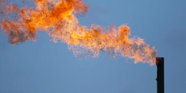
These loss rate estimates do not account for the vast quantities of gas being wasted through flaring (burning off methane rather than selling it) in places like the Permian, Eagle Ford and Bakken basins.
What the data tell us
MethaneAIR data comes from over 30 flights from June to October of last year by a specially equipped jet aircraft chartered by EDF. Flights were carefully tailored to cover areas accounting for over 70% of all US onshore oil and gas production in the lower 48 states. The MethaneAIR data were compared with EPA’s 2020 gridded methane emissions inventory.
- Highest total emissions were seen in the Permian Basin, followed by Appalachian and Haynesville basins, in terms of absolute emissions.
- Gas-dominant basins with high well-site productivity (Appalachian, Haynesville) have comparatively lower, though still unacceptably high, methane loss rates (~1% loss rates) possibly associated with operations that are more focused than elsewhere on delivery of gas production to market.
- Oil-dominant or mixed oil/gas basins (e.g., Permian, Eagle Ford, Bakken) tend to have higher methane emission rates ~2%. These have potential large losses of associated gas production possibly due to inefficient flaring and/or insufficient gas gathering or takeaway capacity.
- Relatively mature basins where oil/gas production and infrastructure is dominated by aging, leak-prone, low producing wells (e.g., Uinta) have extremely high methane loss rates (> 7%), possibly due in part to fugitive methane emissions that continue to go unaddressed even as production declines.
Non-oil/gas emissions were accounted for and excluded from the analysis from all basins when computing oil/gas emissions and loss rates. For example, Appalachian had significant coal/non-oil/gas sources; Denver-Julesburg is another prominent basin where significant non-oil/gas emissions were accounted for.
The new measurements are consistent with other independent estimates using data drawn from ground, aerial and satellite platforms. They are also consistent with Alvarez et al, the synthesis paper published in 2018 based on a groundbreaking series of field studies organized by EDF.
The data shows considerable variation in loss rates between individual oil/gas basins ranging from less than 1% of gross gas production to nearly 8%, as well as the distribution within the basins of large, concentrated sources versus smaller, more diffuse emissions.
These differences may result from factors such as production of oil versus gas, age of facilities, as well as the current regulatory landscape, company operating practices and presence of low- or non-producing wells.
Regardless of the reasons, the emission rates are way too high. New, long-anticipated EPA rules finalized earlier this year by the Biden-Harris administration that leverage widely available, cost-effective solutions, along with methane reduction incentives included in the Inflation Reduction Act, are vital to bringing the numbers down. It is essential that states and EPA move forward with swiftly implementing these protective standards.
With more than 3 million members, Environmental Defense Fund creates transformational solutions to the most serious environmental problems. To do so, EDF links science, economics, law, and innovative private-sector partnerships to turn solutions into action. edf.org
Latest press releases
-
Groups Voice Concern Over Current State Impasse on Colorado River Management
February 13, 2026 -
Massachusetts Regulators Open the Door for Community Voices in Energy Decisions
February 13, 2026 -
Trump EPA Overturns Endangerment Finding
February 12, 2026 -
Trump EPA Misses Legal Deadline to Reduce Deadly Air Pollution
February 11, 2026 -
California Leads on Smarter, More Flexible Electric Grid Connections
February 10, 2026 -
EDF Calls on Energy Secretary, National Archives to Ensure Proper Preservation of Records
February 10, 2026


