


Los Angeles Area: Snapshot of natural gas leaks under city streets
Leaked natural gas – mostly methane – is a powerful contributor to climate change.
Explore Los Angeles Area map data
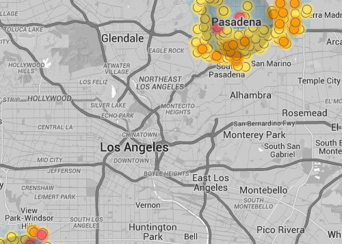
Click for interactive map
If you ever smell gas, or have any reason to suspect a problem, experts say to immediately exit the building or area, then call the authorities. For more, see the Southern California Gas Company safety page.
Findings
Our readings indicated an average of about one leak for every four miles we drove in Pasadena, every five miles we drove in Inglewood, every five miles we drove in Chino and every six miles we drove in Orange.
Readings are from August 2014 through May 2015 and may not reflect current leaks, due to repairs or other changes. Data from these cities is not necessarily representative of the entire area.
About the area's natural gas infrastructure
- Utility: The Los Angeles Area is serviced by Southern California Gas Company. We mapped four geographically diverse cities within the company's service area. Most leaks don't pose an immediate threat to safety or health, but some can. We have shared this data with Southern California Gas Company. Read a Q&A about methane mapping in the Los Angeles Area [PDF].
- Pipe materials: About 16% of Southern California Gas Company's pipes are made from corrosive and leak-prone materials.
- Age of pipes: More than 38% of the pipes in Southern California Gas Company's territory are more than 50 years old.
- Natural sources of methane: Biological processes can cause elevated methane concentration in the air. To confidently attribute elevated methane levels to pipeline leaks, we mapped areas that are far enough from known natural methane sources like landfills, wetlands, and water treatment plants.